Digital applications
Nowadays, digital technology is inextricably intertwined with archaeological studies. In the excavation at Toumba, the use of digital technology has three dimensions:
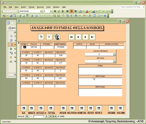
- Storing and organization of data that has come to light during the excavation as well as during the study of the archaeological material.
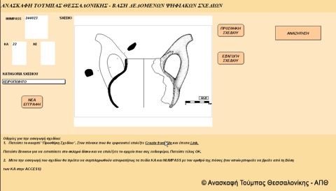
- Digitization of all analog format photographs as well as editing of all photographs, object designs and designs of the excavation in electronic format.
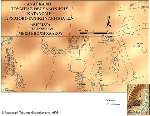
- Spatial data analysis, using Geographical Information Systems (GIS).
Data storing and organization:
At Toumba excavation, all information that comes to light during the excavation and the study of the archaeological material is being stored in electronic databases. The software used is Microsoft Access and FilemakerPro
Digitization and editing of photographs in electronic format:
The vast number of photographs taken during the excavation documents its progress, the findings, as well as the nature of the activities in the trenches and in the excavation laboratory. Moreover, the study of the material as well as of the excavation activity is inextricably intertwined with surveying of the architectural remains of the stratigraphy and the drawings of the findings.
Nowadays, all this volume of information is digitized through scanning. After scanning, the photographs of the excavation and those of the objects and vases are processed. All designs are converted into vector format through AutoCAD (architectural designs and stratigraphies) or CorelDRAW (pottery and objects designs).
Spatial data analysis:
The position of all excavation data at the site is measured with a Total Station. Consequently, the spatial distribution and the correlation of all information with the stable findings at the site of the excavation (house walls and constructions, such as hearths, silos, floors, etc.) are made possible with the usage of Geographical Information System (GIS).
Examples of analyses occurring within a GIS environment:
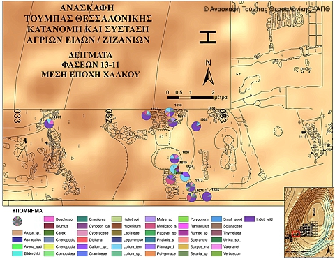
Spatial analysis within the framework of archaeobotanical research:
The aim of the present analysis was to investigate the archaeobotanical samples distribution, both in the area of the settlement taken up by buildings Μ and G in total, as well as per occupation phase.
Moreover, it was investigated whether there is any correlation between the archaeobotanical samples composition (regarding composition in remains from both seeds and weeds) and the location where those were found (whether they were on floors or in pits, etc).
Spatial analysis within the framework of the study of storage in the Toumba settlement:
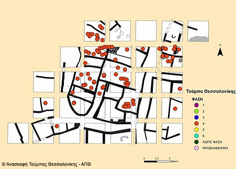
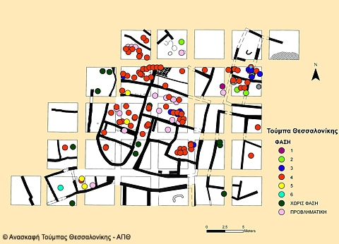
Within the framework of the study of storage in the Toumba settlement, a thematic map with the distribution of the storage jars across the settlement per residential phase was created. The aim was to examine whether the way of organization and storage from phase 4 (1220-1100 BC) to the later phases 3 (1100-1050 BC) and 2 (1050-900 BC) had changed.
Indeed, as it became evident from the maps of the storage jars distribution in the settlement, storage at Toumba was concentrated within limited spaces in individual building complexes during phase 4. On the contrary, during the earlier phases 3 and 2, the nature of storage changes, with storage jars being found nearly in every space of the building complexes.
.


